Log in
All resources
Create a design
33,693 Free Images of 1600 Maps
atlas of the russian empire (1800)
geographical illustrations by coronelli
bibliothèque municipale de reims
rès. g 153
1889 maps
quaternary geology
popular science monthly illustrations/volume 34
engravings of kythira
maps of kythira
atmospheric circulation
maps of gamla stan
1862 in stockholm
maps by gerardus mercator
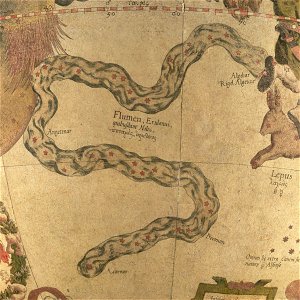
eridanus in art
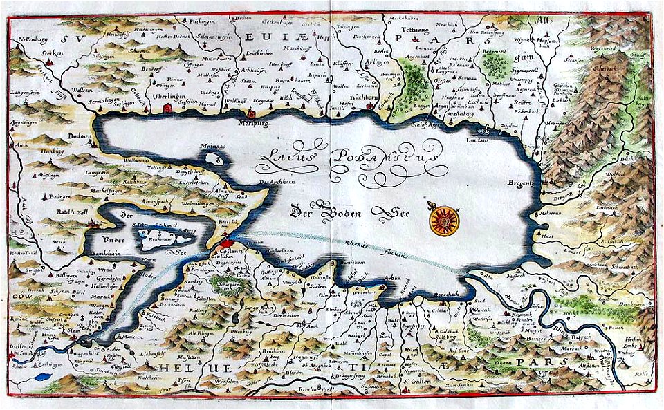
naval war on lake constance
old maps of lake constance
bibliothèque municipale de reims
rès. g 153
bibliothèque municipale de reims
rès. g 153
geographical illustrations by coronelli
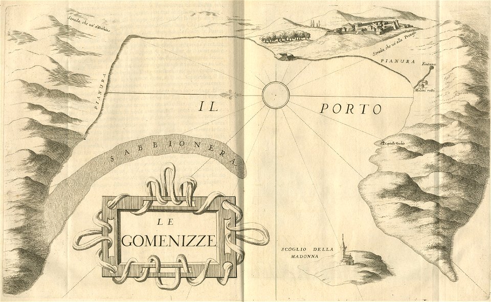
engravings of igoumenitsa
images from the new student's reference work
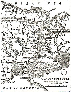
maps of constantinople
description de l'universe
zanzibar in art
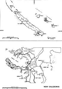
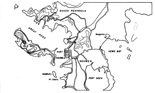
nouméa in world war ii
nouméa
small atlas of the russian empire (1796)
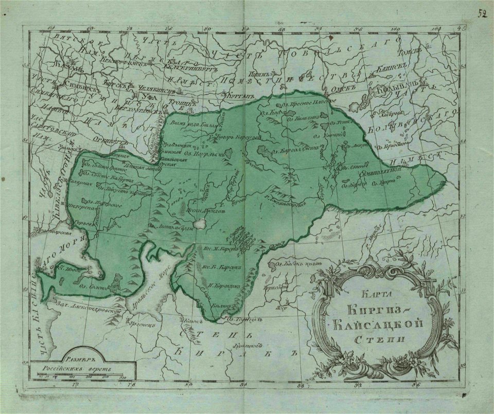
maps of kazakhstan
nouméa in world war ii
nouméa
yamaguchi prefectural archives
maps of yamaguchi prefecture
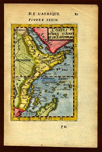
description de l'universe
zanzibar in art
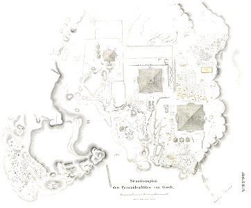
lepsius-projekt - pyramids
plans of giza necropolis
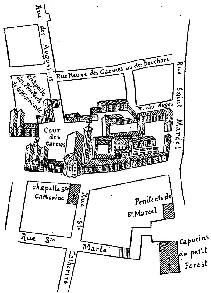
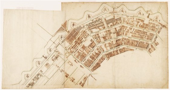
les anciens couvents de lyon
16th-century maps of lyon
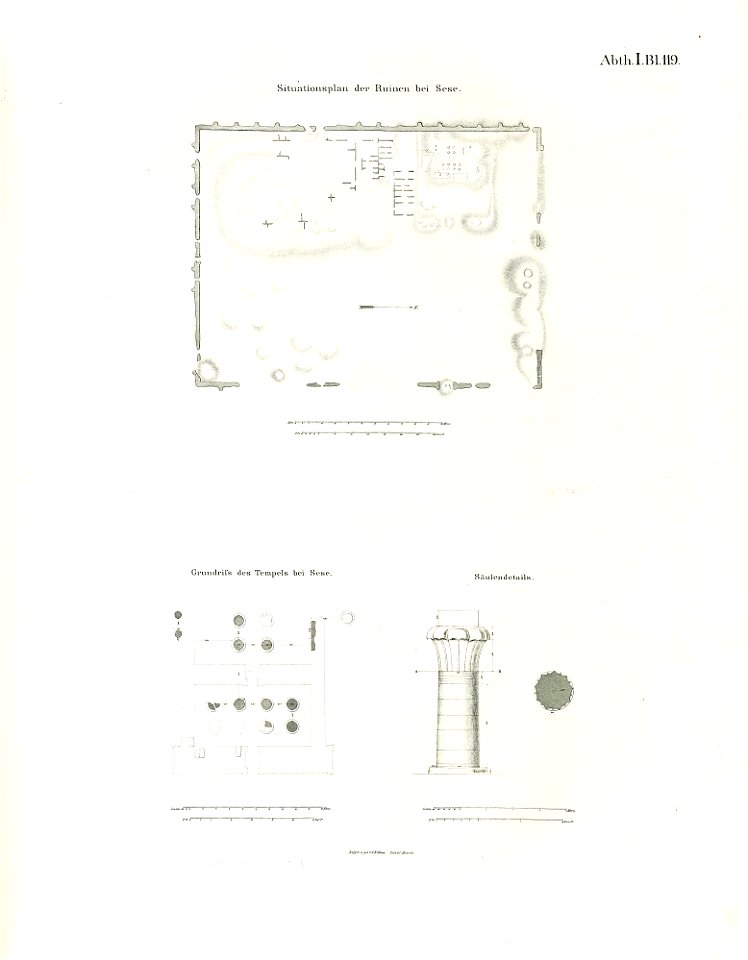
lepsius-projekt - temples
lepsius-projekt - maps
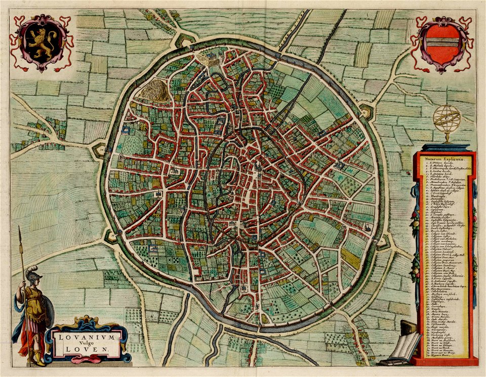
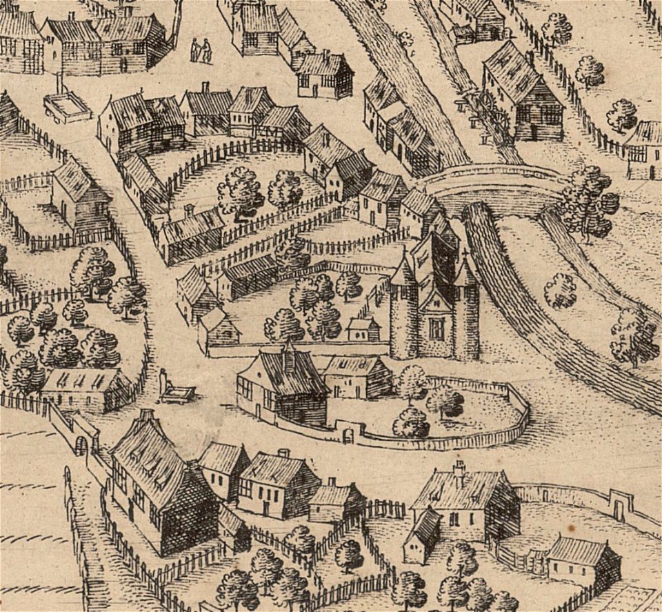
old maps of leuven
atlas van loon
geographical illustrations by coronelli
engravings of kythira
geographical illustrations by coronelli
engravings of kythira
semnopithecus
colobus
history of hanau
maps of hanau
gorilla
pongo
prints from the peace palace library
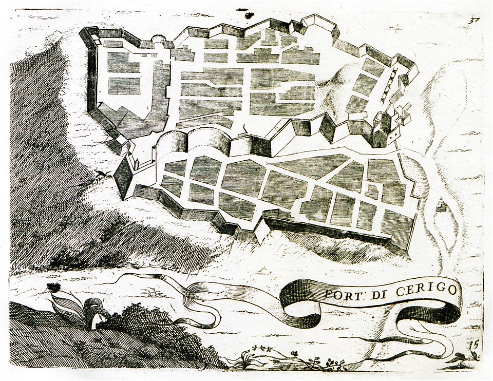
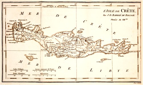
old maps of crete
history of sanssouci
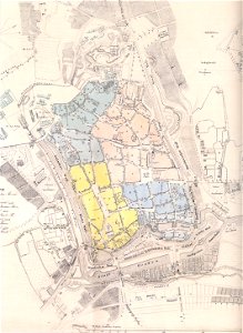
maps of potsdam
historical maps of lüneburg
stadtarchiv lüneburg
bibliothèque municipale de reims
rès. g 153
drawings by samuel de champlain
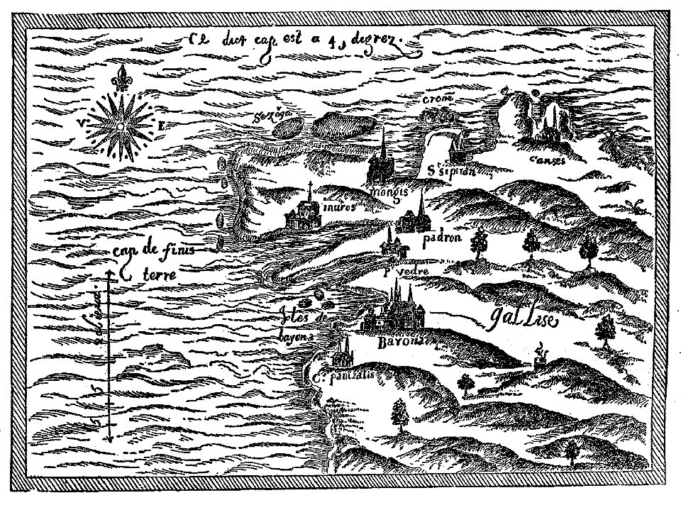
old maps of galicia (spain)
geographical illustrations by coronelli
engravings of kythira
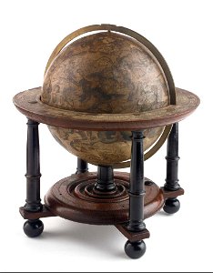
charts and maps of the royal museums greenwich
celestial globe
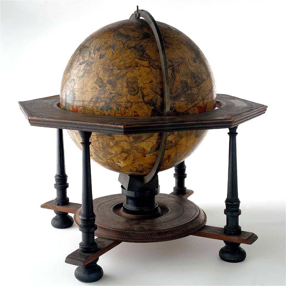
charts and maps of the royal museums greenwich
celestial globe
old maps of bremen (state)
bremen in the 1870s
nicolaes van geelkercken
frederick de wit
maps of the history of syria
books by gaston maspero
maps of the mexican drug war
drug cartels of mexico
popular science monthly illustrations/volume 48
1896 maps
popular science monthly illustrations/volume 48
1896 maps
la serena
chile
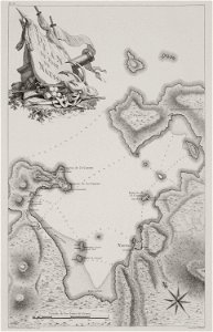
voyage pittoresque de la grèce
naoussa (paros)
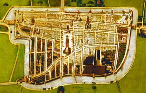
paintings in the museum het prinsenhof
old maps of delft
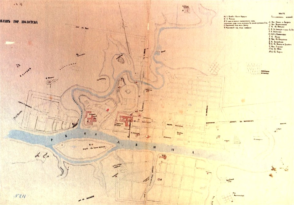
paintings of połacak by dmitry strukov
old maps of polotsk
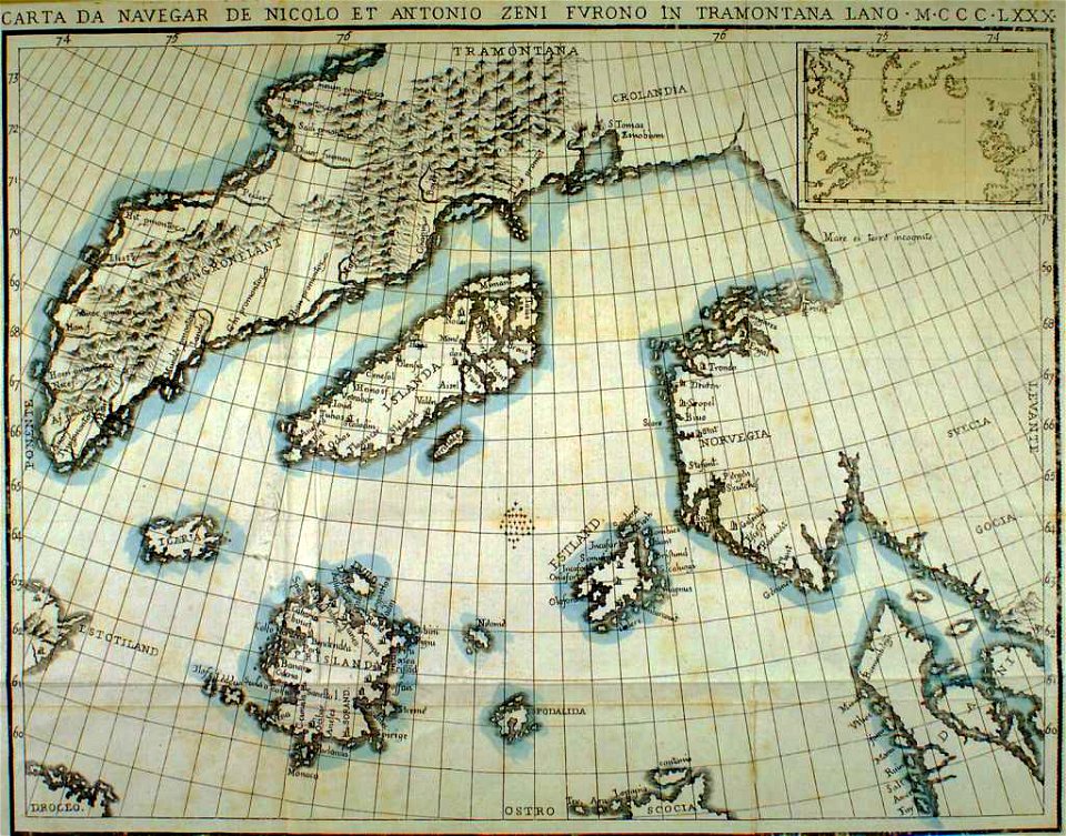
provided by landsbókasafn íslands
maps made in the 19th century
history of weingarten (württemberg)
maps by wenzel hollar
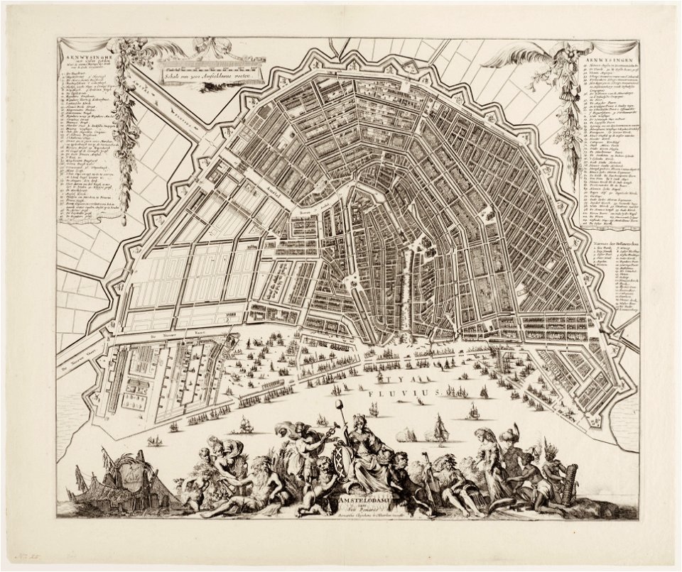
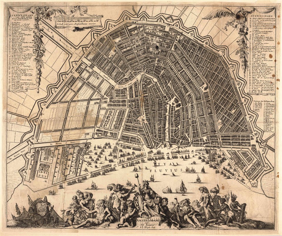
amsterdam in the 1680s
old maps of amsterdam
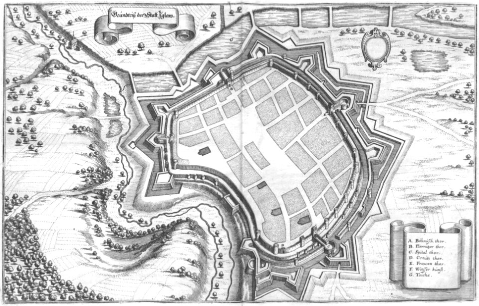
engravings of topographia bohemiae moraviae et silesiae
maps of jihlava
relation of a journey (sandys)
17th-century maps of jerusalem
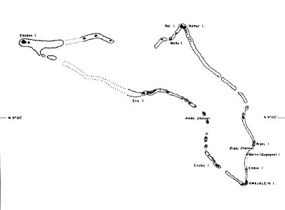
kwajalein atoll during world war ii
maps of kwajalein atoll
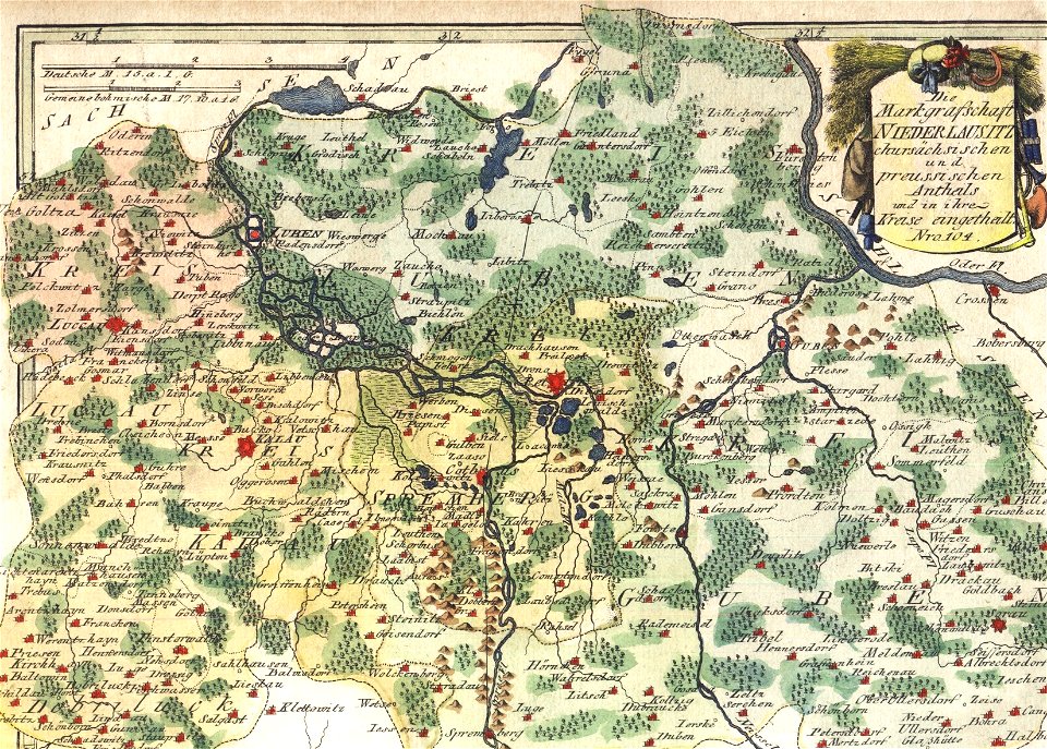
schauplatz der fünf theile der welt
old maps of lusatia
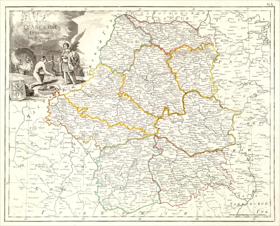
atlas of the russian empire (1800)
maps of tula governorate
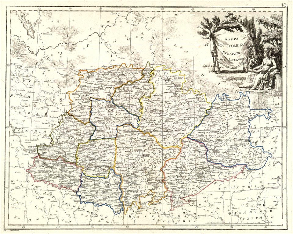
atlas of the russian empire (1800)
maps of kostroma governorate
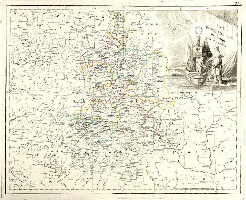
atlas of the russian empire (1800)
maps of voronezh governorate
bibliothèque municipale de reims
rès. g 153
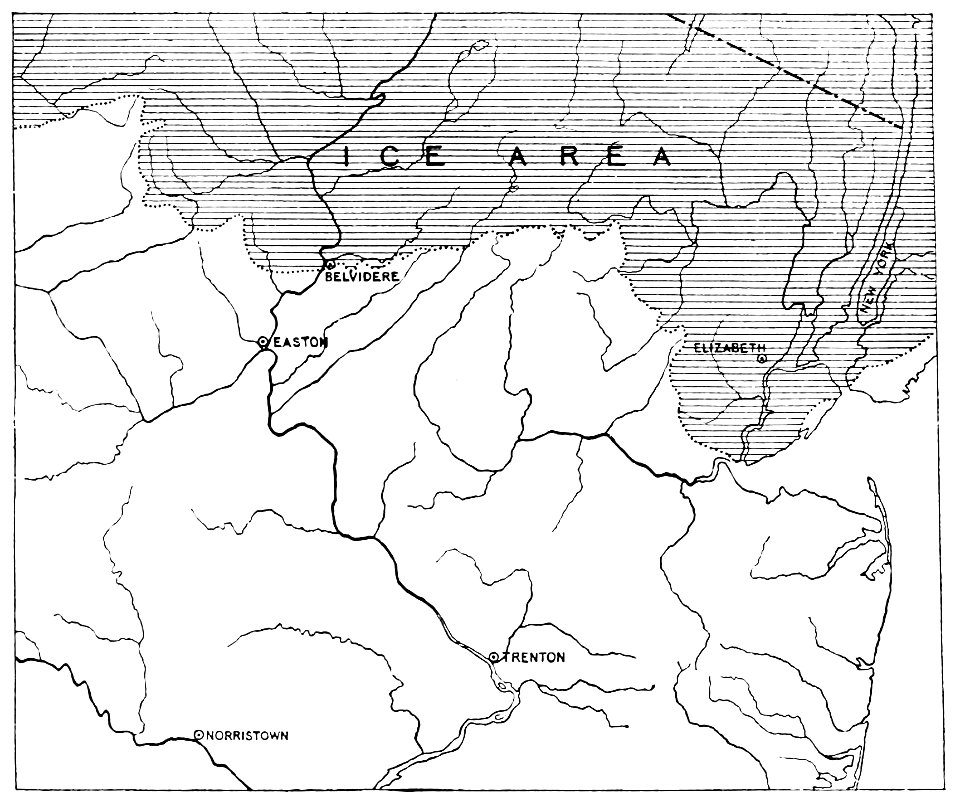
quaternary geology
1889 maps
quaternary geology
1889 maps
quaternary geology
1889 maps
quaternary geology
1889 maps
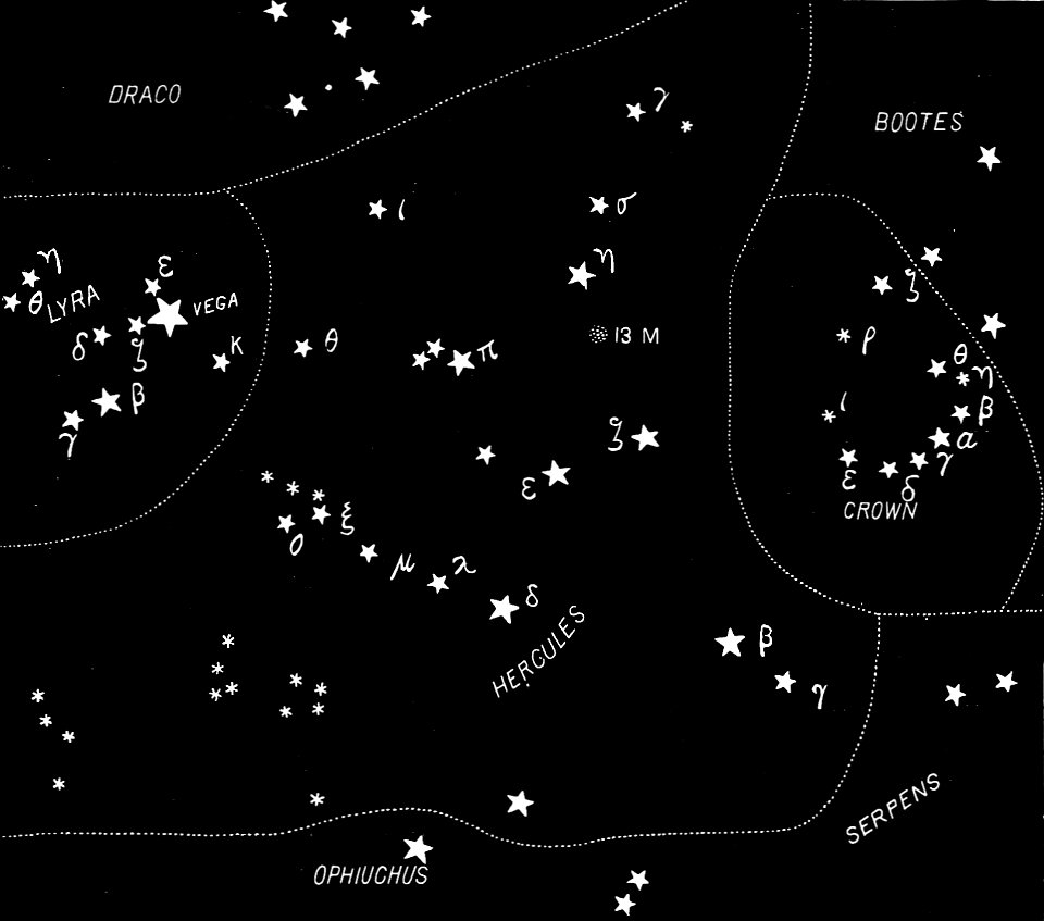
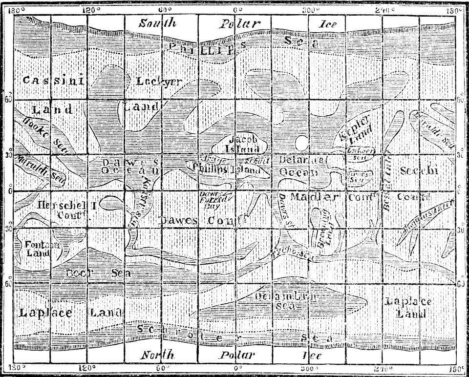
popular science monthly illustrations/volume 31
english-language constellation maps
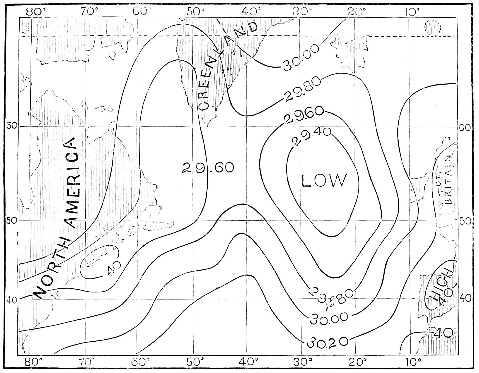
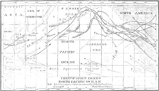
atmospheric circulation
1880 maps
atmospheric circulation
1880 maps
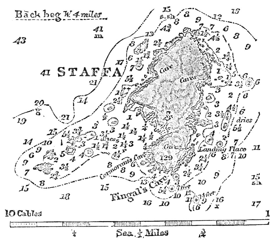
fingal's cave
1883 maps
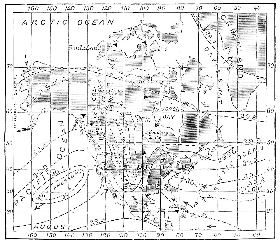
atmospheric circulation
1880 maps
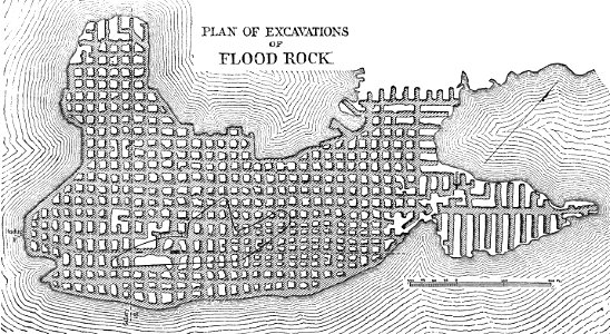
hells gate
1886 maps
popular science monthly illustrations/volume 4
old maps of mars
maps by homannsche erben
johann baptist homann
prints from the peace palace library
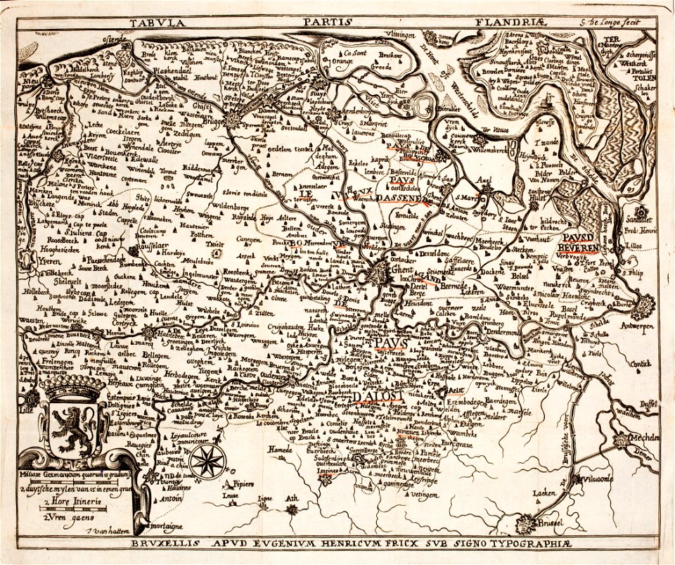
old maps of flanders
new york public library manuscripts
17th-century maps of saxony
romeyn de hooghe
gerard valck
engravings of topographia bohemiae moraviae et silesiae
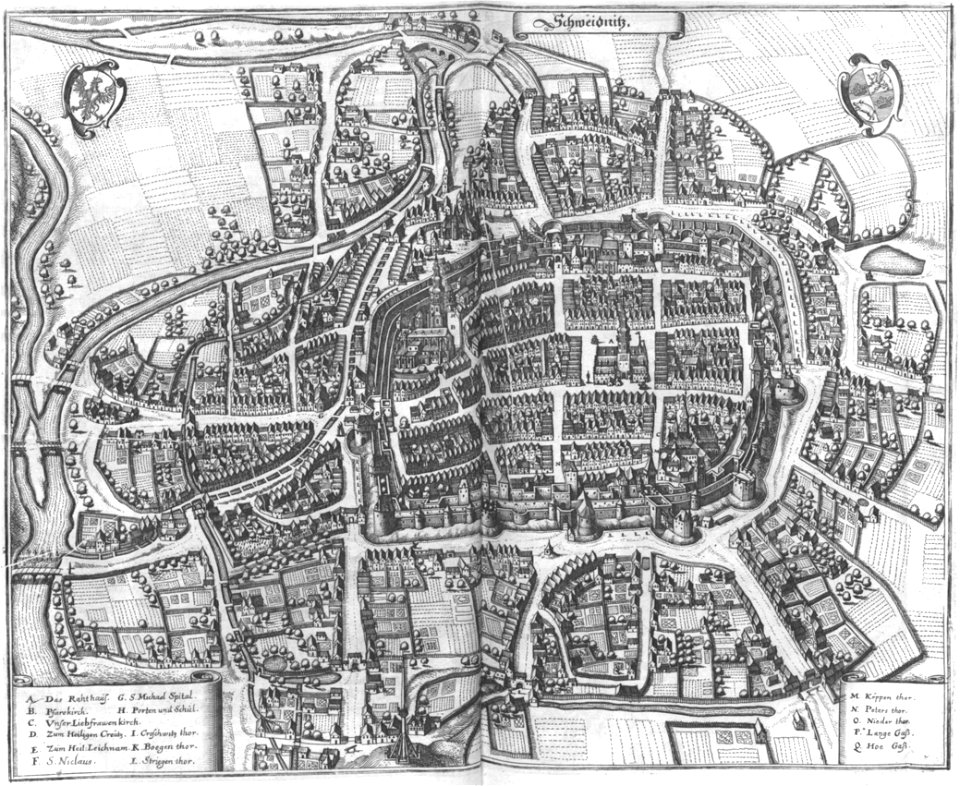
maps of świdnica
old maps of lake constance
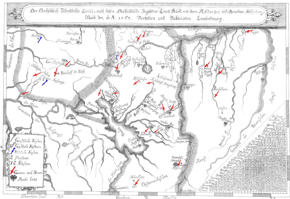
nobility of swabia
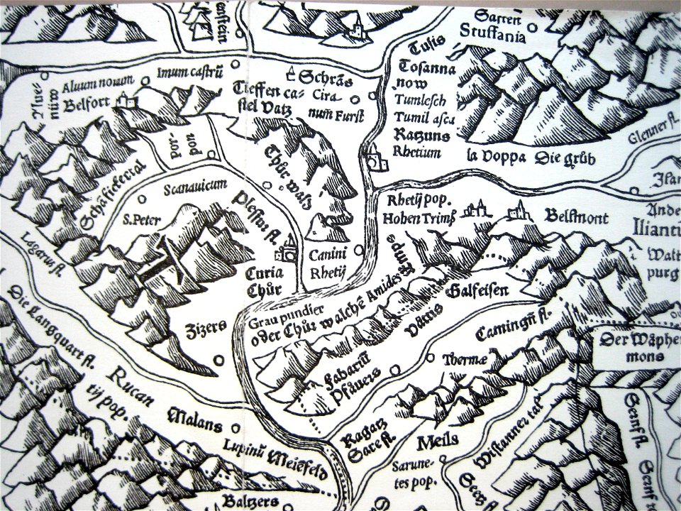
historical images of chur
old maps of switzerland
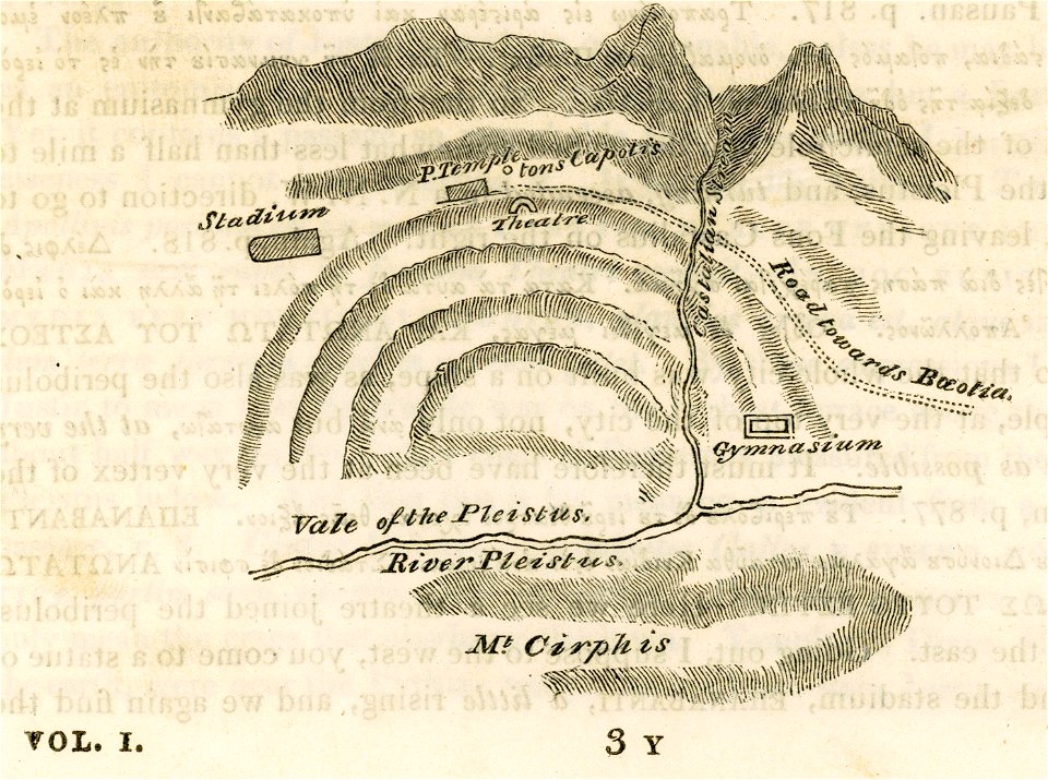
travels in sicily greece and albania
maps of ancient delphi
atlas of the russian empire (1800)
maps of ryazan governorate
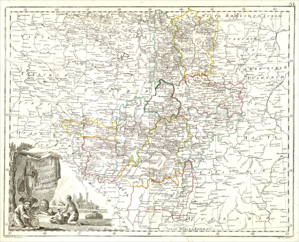
atlas of the russian empire (1800)
maps of tambov governorate
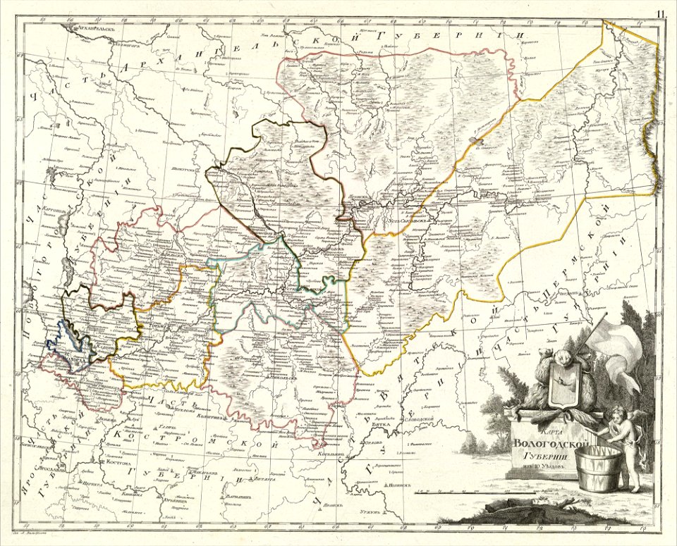
atlas of the russian empire (1800)
maps of vologda governorate
atlas of the russian empire (1800)
maps of kazan governorate
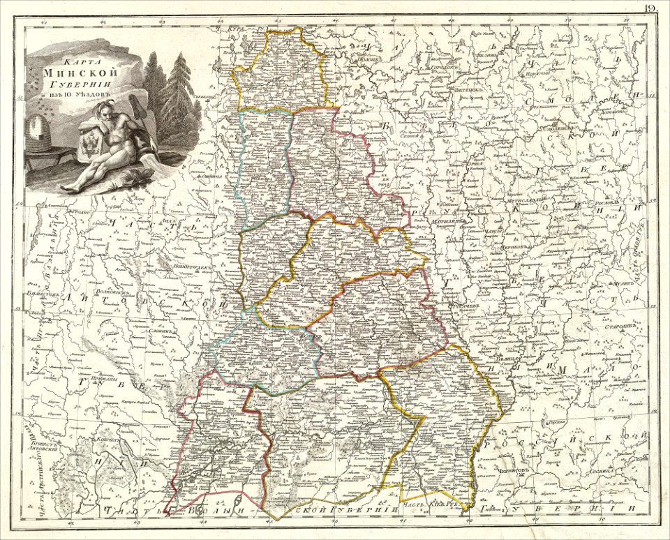
atlas of the russian empire (1800)
maps of minsk governorate
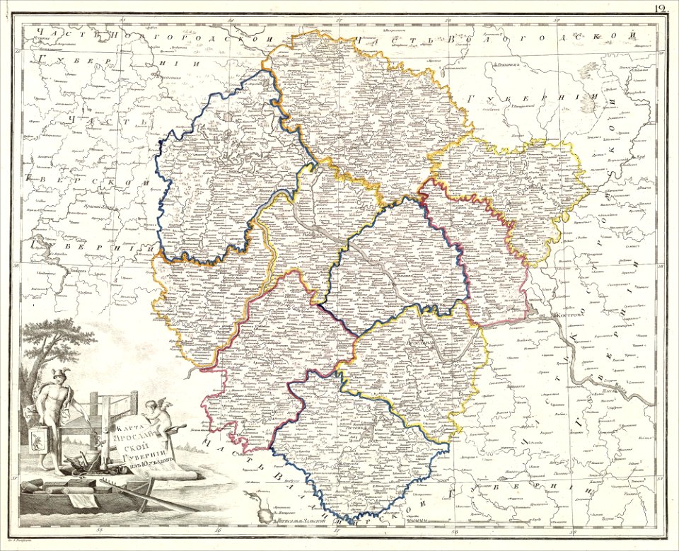
atlas of the russian empire (1800)
maps of yaroslavl governorate
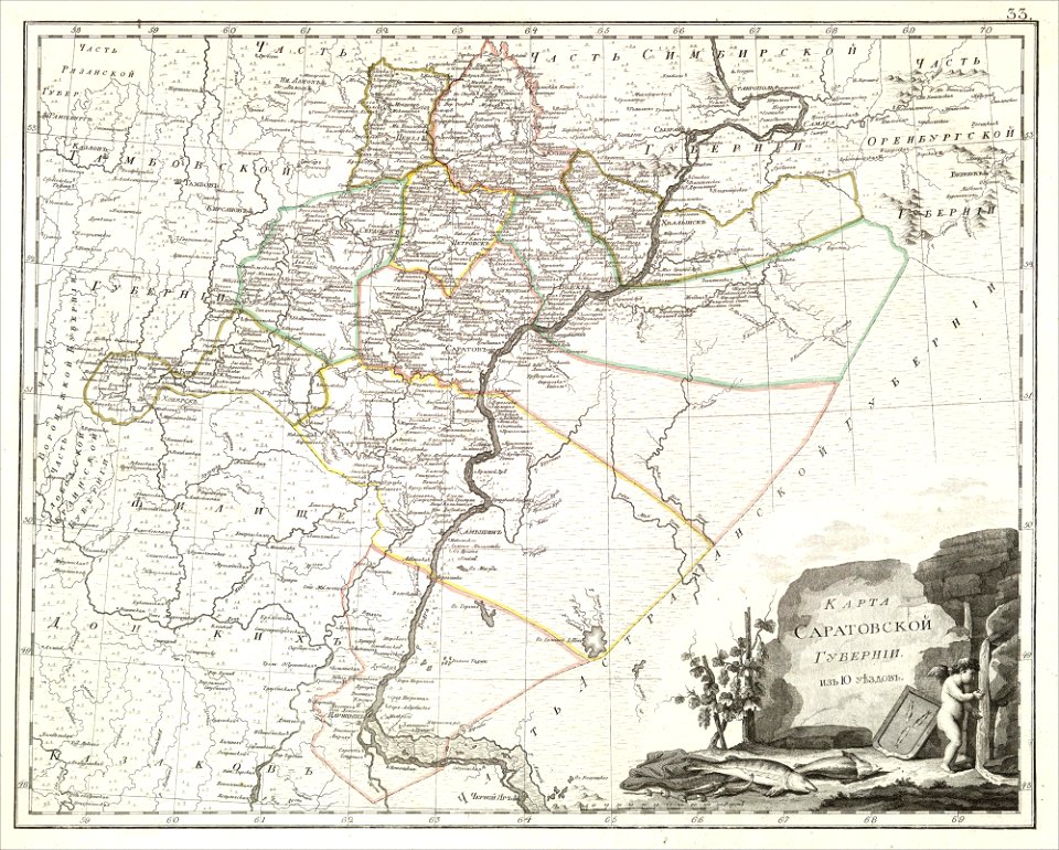
atlas of the russian empire (1800)
maps of saratov governorate
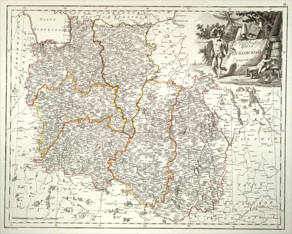
atlas of the russian empire (1800)
maps of pskov governorate
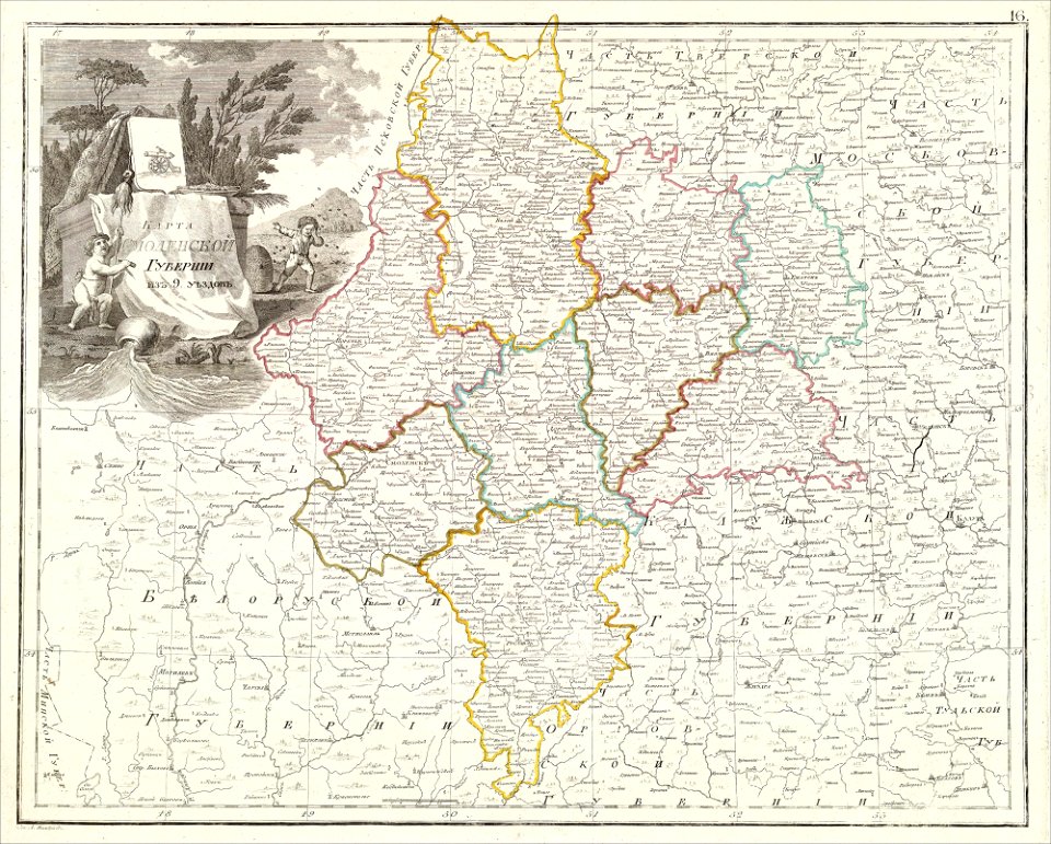
atlas of the russian empire (1800)
maps of smolensk governorate
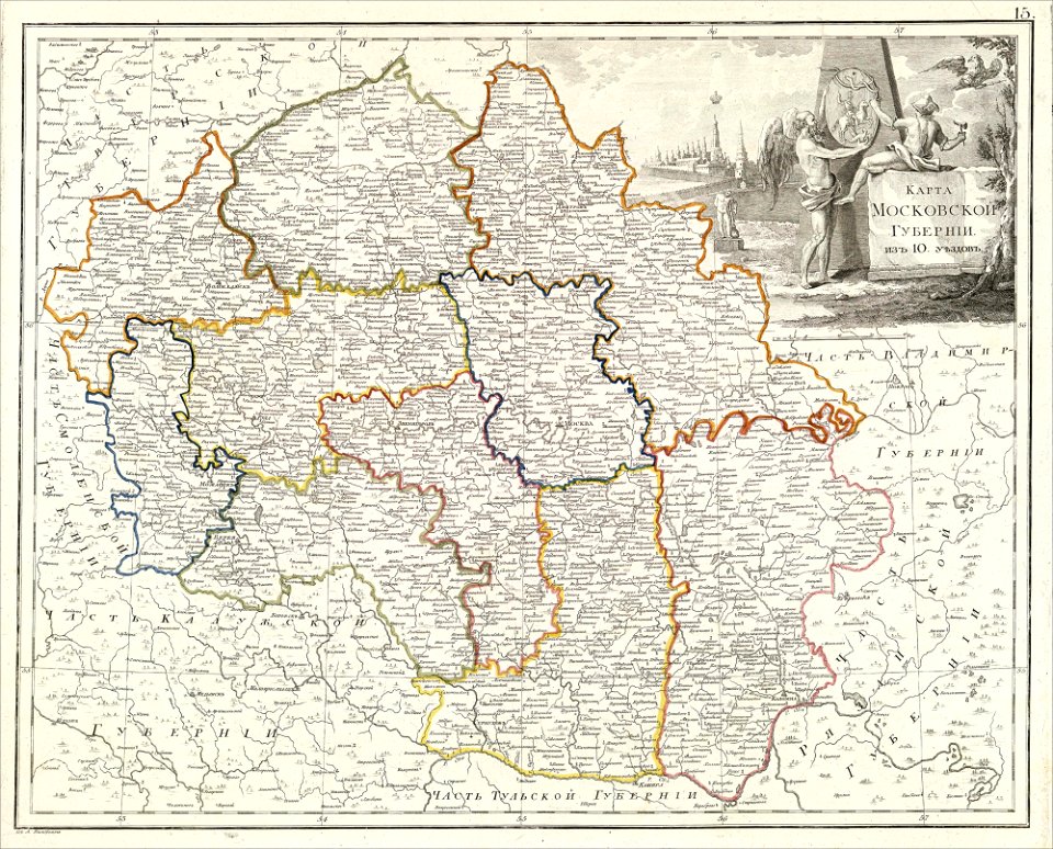
atlas of the russian empire (1800)
maps of moscow governorate
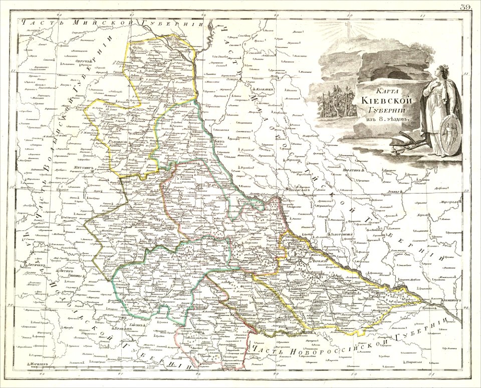
atlas of the russian empire (1800)
maps of kiev governorate
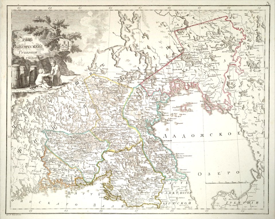
atlas of the russian empire (1800)
maps of wyborg governorate
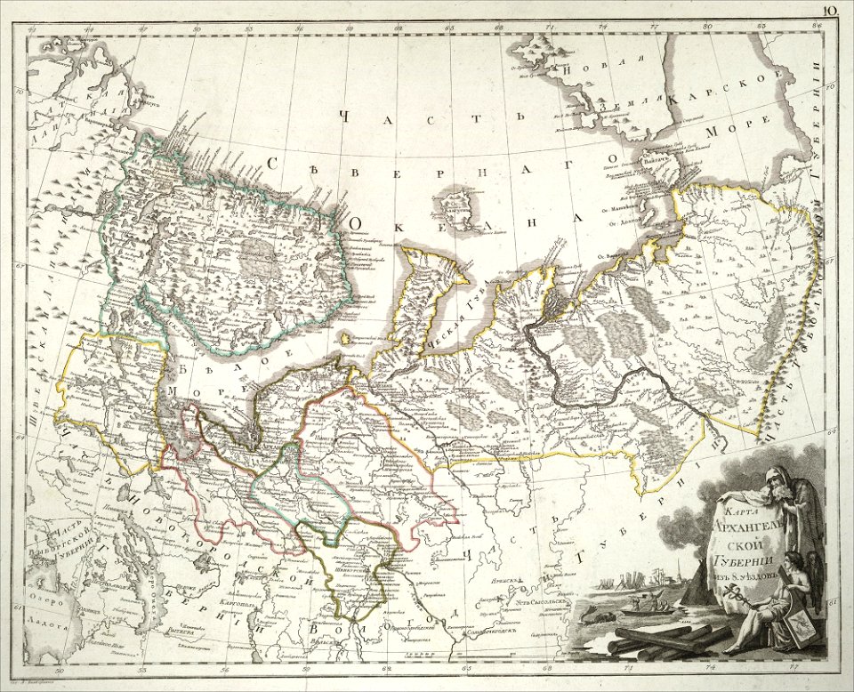
atlas of the russian empire (1800)
maps of arkhangelsk governorate
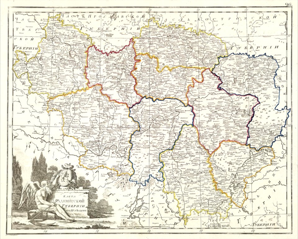
atlas of the russian empire (1800)
maps of vladimir governorate
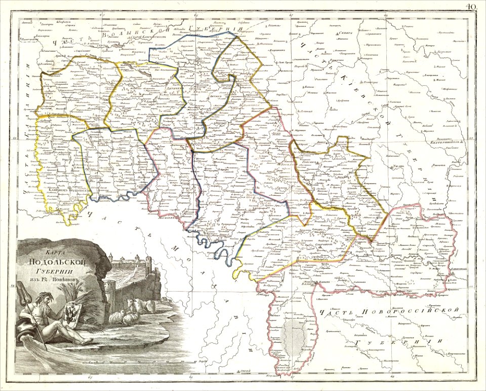
atlas of the russian empire (1800)
maps of podolia governorate
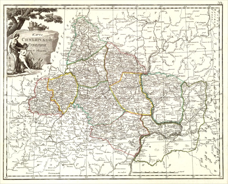
atlas of the russian empire (1800)
maps of simbirsk governorate
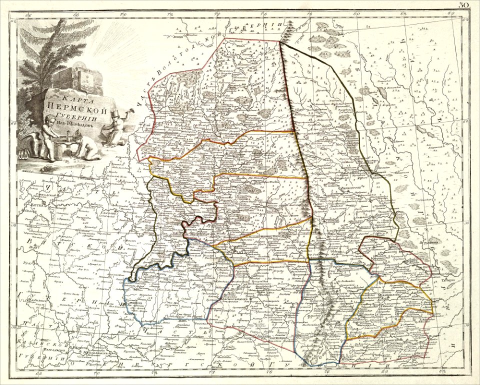
atlas of the russian empire (1800)
maps of perm governorate
romeyn de hooghe
gerard valck
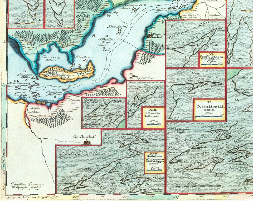
schlei
arni
old maps of dutch brazil
johannes vingboons
liber insularum archipelagi (royal museums greenwich)
maps of kea (cyclades)
maps of stockholm county
tyresö slott
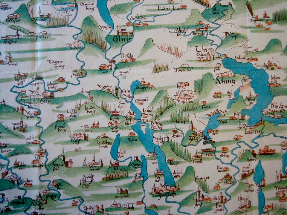
old maps of the canton of zürich
cartography of switzerland
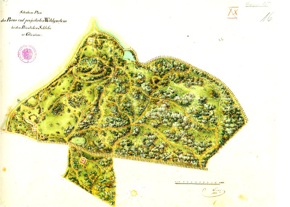
königstraße (berlin-wannsee)
park klein-glienicke
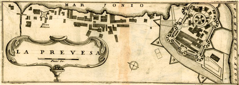
geographical illustrations by coronelli
maps of preveza
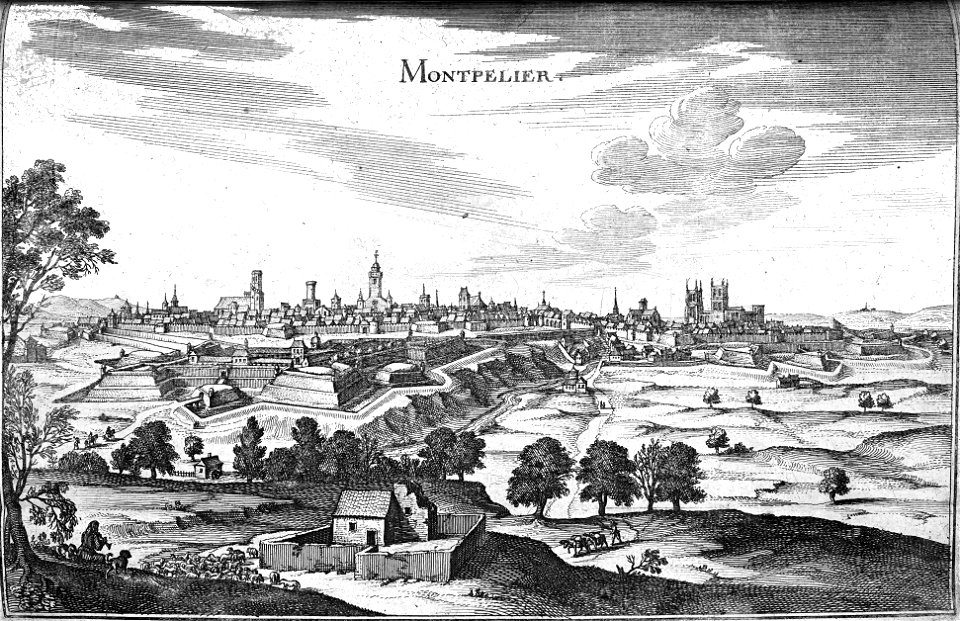
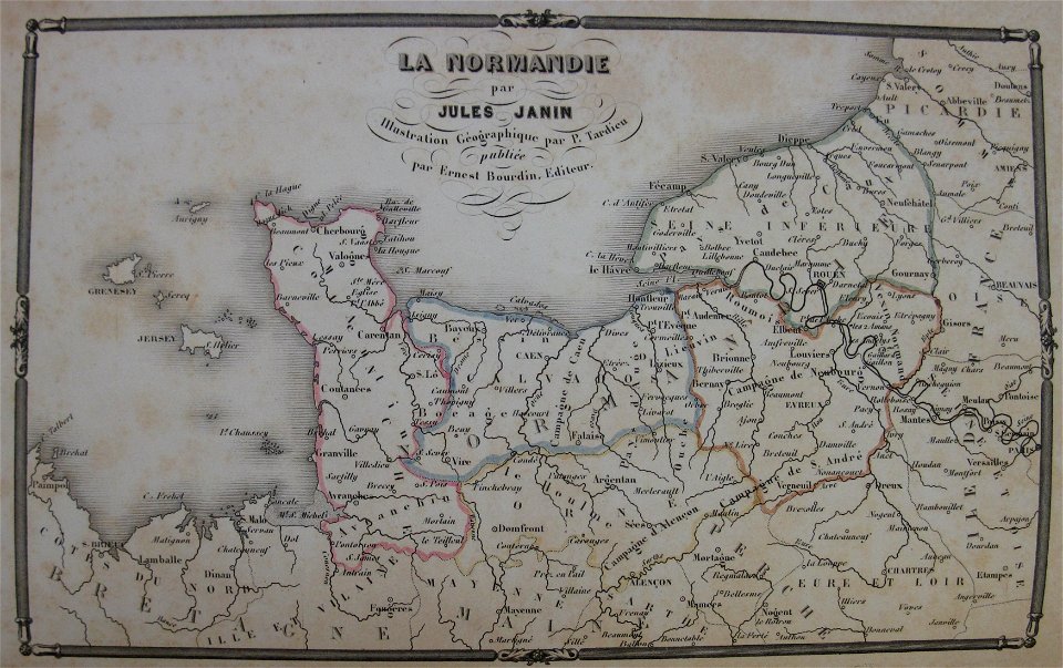
la normandie (jules janin)
alfred johannot
1751 maps of rhineland-palatinate
neuwied in the 18th century
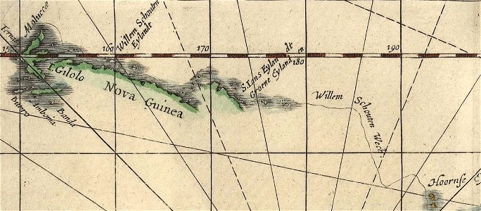
willem schouten
jacob le maire
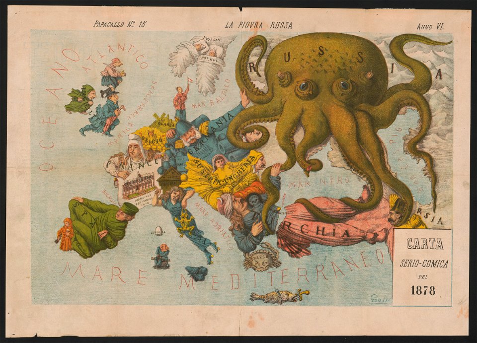
19th-century satirical maps
europe in the 1870s
geographical illustrations by coronelli
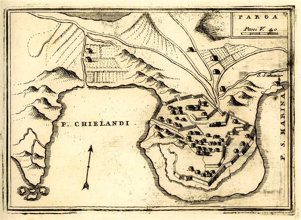
engravings of parga
7801 - 7900 of 33,693
Next page
/ 337